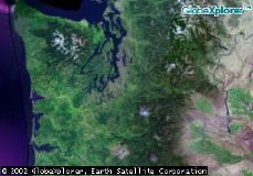
 Obviously, this is the state of Washington. The "white spot" near the center is Mount Rainier. To the top left is the Olympic Pennisula, with the snow capped Olympic Mountain Range. In between the two is Puget Sound. |
 Zooming in, you can still see Mount Rainier at the bottom of this picture. Mt. Stuart is to the far right of the screen, also snow capped. I work in North Bend, about 50 miles west of Mt. Stuart, on the edge of the Cascades. The very small lighter blue area just about dead center is Lake Tapps. |
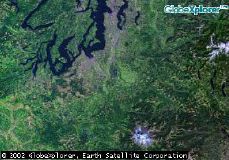
 The off green area just a bit above center is Lake Tapps. The river running north of it is White River, It feeds Lake Tapps through a "shunt". The river is fed by the glaciers on top of Rainier. The odd color in the lake is caused by "glacial milk". Due to this, the lake sometimes tends to have an almost greenish glow to it. |
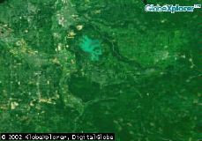
 You can still see Lake Tapps to the north and most of Bonney Lake. Look for the darker green triangle, just left of center, and your starting to close in on my house. |
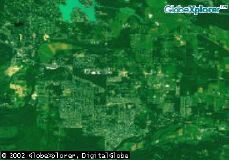
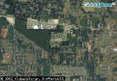 The main road running left to right is hwy 410. The dark green triangle is now to the left, and is a nice stand of trees that covers several blocks and is mostly untouched. It borders our housing park to the west. |
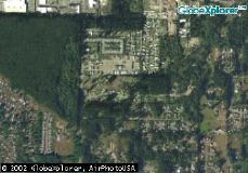 If you look, you can see a square just north of center. Our park is just south of that square. |
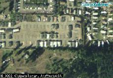 Just above center of this photo is a group of 5 houses. Ours is the one furthest to the left. That's me waving up at you from the front door, now stop spying on me. |